Integrating Location-Based Triggers with Narrative Branches in Mobile Story-Driven Apps to Enhance Immersion Through Real-World Movement Alignments

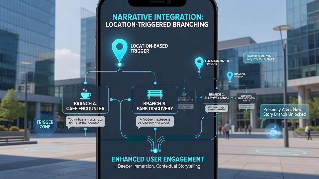
Developers integrate location-based triggers into mobile story-driven apps by connecting GPS coordinates and geofencing data directly to narrative decision points, which allows plot developments to activate only when users reach specific physical locations. This approach requires precise mapping of story branches to real-world coordinates so movement through cities or neighborhoods advances character arcs and reveals new dialogue options without breaking the fictional flow.
Mechanics of Location Triggers in Narrative Structures
Apps use device sensors to monitor user position and trigger conditional scripts when predefined boundaries are crossed, and this process often combines with accelerometer readings to detect walking speed or direction changes that influence how quickly branches unfold. Researchers at institutions such as the National Institute of Standards and Technology have documented how geofence accuracy improves when apps cross-reference satellite data with Wi-Fi signals, reducing false triggers that could disrupt story pacing. Data from multiple deployments shows that branches tied to movement create tighter connections between physical progress and emotional beats, as characters react to environments the user actually passes through.
Story trees expand when location events feed into variable states, for instance a protagonist might choose different allies depending on whether the user detours through a park or follows a main road. Developers store these conditional nodes in backend databases that update in real time, allowing the same base script to generate dozens of unique sequences based on route choices.
Aligning Movement Patterns with Branching Outcomes
Real-world movement alignments function through layered condition checks that compare user velocity and path history against story requirements, and this method ensures narrative events feel responsive rather than arbitrary. Observers note that when apps calculate estimated arrival times at trigger zones they can preload audio or visual assets, which keeps transitions smooth during walking segments. In June 2026 several development teams shared telemetry from pilot programs demonstrating that users who followed suggested routes completed more branches per session than those who deviated, although completion rates varied by urban density and signal strength.
Case implementations often feature urban exploration titles where crossing a river bridge activates a confrontation scene while entering a market square unlocks side conversations, and these alignments rely on pre-authored location polygons that map onto city layouts. Engineers refine polygon edges using historical GPS noise data to prevent activation glitches near tall buildings or tunnels. The process also incorporates fallback timers so stories progress even if signal loss occurs, maintaining continuity across variable network conditions.
Technical Integration Approaches
Teams combine mapping APIs with custom scripting engines that translate latitude and longitude values into story flags, and they frequently test these systems across multiple device models to verify consistent trigger timing. According to findings published by the European Commission's Joint Research Centre, fusion of GPS with cellular triangulation improves trigger reliability in dense areas by up to 40 percent compared with satellite-only methods. Developers then map these reliable triggers onto dialogue trees using node-based editors that visually link physical zones to narrative outcomes.
Additional layers include time-of-day filters that alter branch availability, so a nighttime visit to the same location might reveal different character motivations than a daytime passage. Such filters require synchronized device clocks and server verification to prevent tampering, which maintains fairness across player experiences.
Current Implementation Patterns and Data Trends
Industry reports indicate that story apps incorporating movement-based triggers see longer average session durations because users adjust their physical routes to explore alternate endings. Researchers tracking adoption rates across North American and Asian markets have recorded higher retention when apps provide optional route suggestions that align with public transit options or pedestrian paths. These patterns emerge because the physical act of walking mirrors the narrative journey, creating parallel progression that reinforces immersion without requiring additional screen interactions.
Security considerations involve anonymized location data handling, and frameworks from bodies such as Australia's Digital Transformation Agency outline consent flows that let users toggle tracking while preserving story functionality. Implementation teams routinely audit these systems to ensure location history does not persist beyond active sessions unless explicitly stored for progress saving.
Conclusion
Integration of location-based triggers with narrative branches continues to evolve through refined sensor fusion and improved mapping accuracy, which enables story-driven mobile apps to tie fictional events more closely to users' actual movements. Ongoing refinements in geofencing precision and conditional scripting support broader deployment across varied environments while preserving narrative coherence. Data collected through 2026 indicates steady growth in titles adopting these techniques, driven by both technical advancements and user interest in experiences that reward physical exploration.